Google Cloud Storage (GCS) Setup Guide
A step-by-step guide for creating and configuring Google Cloud Storage buckets.
Google Cloud Storage is a data storage service that allows you to store binary and unstructured data. It is a cheap and fast option to store geospatial data in cloud-optimized formats such as Cloud Optimized GeoTIFFs (COGs), Zarr archives and GeoParquet files. This guide will show you how to use this service to activate the service, create a bucket, configure it for public access and upload your data.
This is a simplified guide for our course participants and not an official document. Refer to the Google Cloud Storage Documentation for official instructions.
Before You Start
To use the Google Cloud Storage service, you must have a Google Cloud Project with billing enabled. See our Google Cloud Sign-up Guide to learn how to setup a project and enable billing.
Create a Bucket
A Bucket is the top-level container in Google Cloud Storage. It is like a folder that can contain other folders and files. Let’s create a bucket.
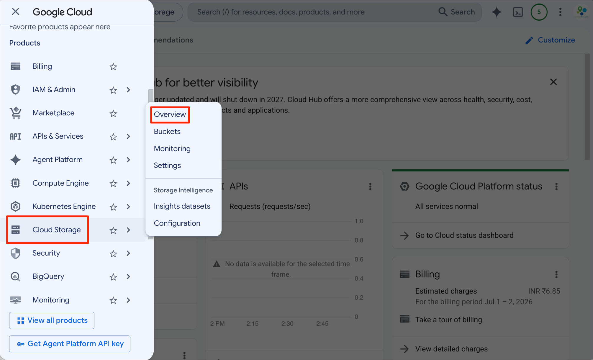
- Open your Google Cloud Console. Open the menu from the left-hand panel and go to the Cloud Storage → Overview.
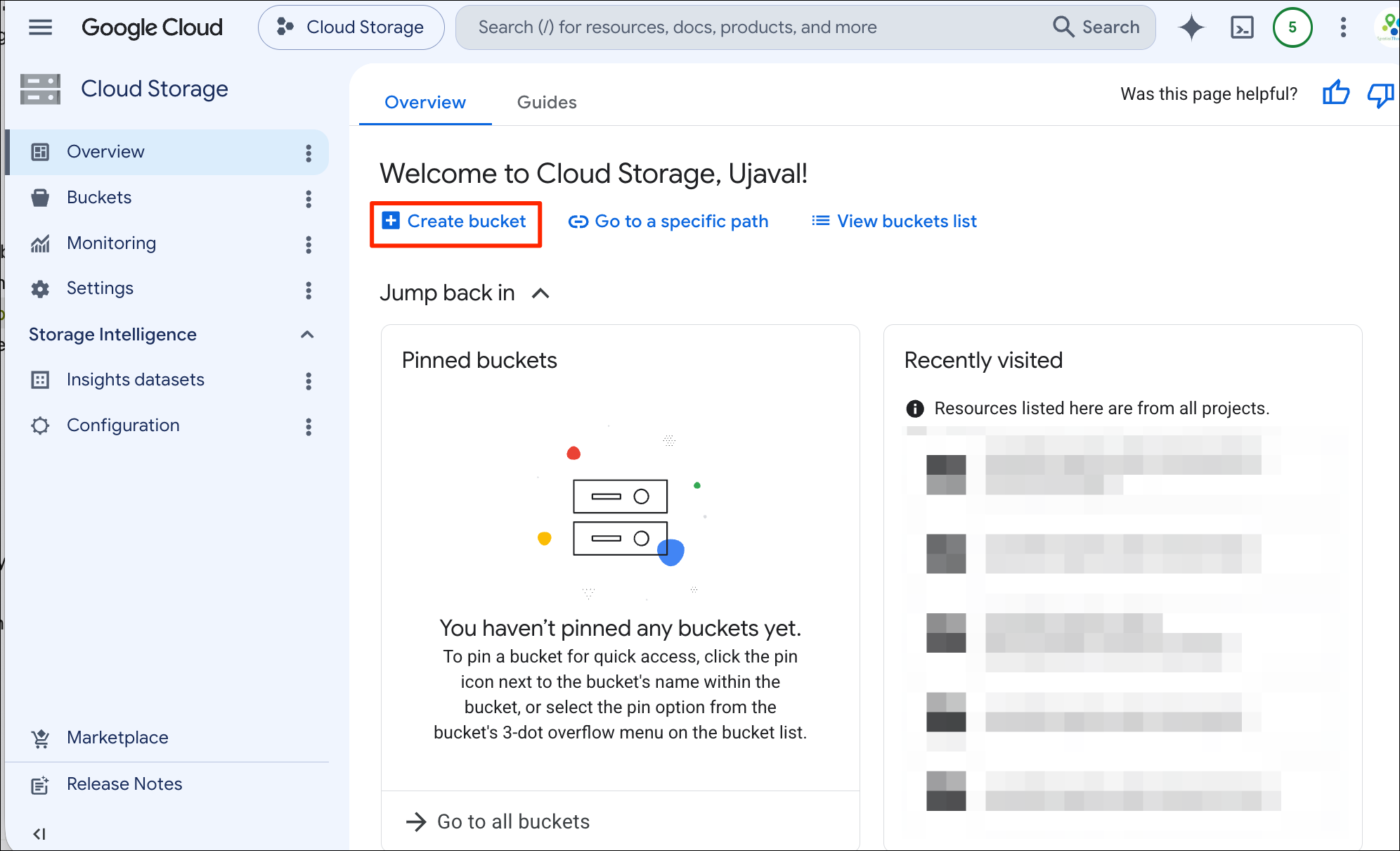
- Click the + Create bucket button.
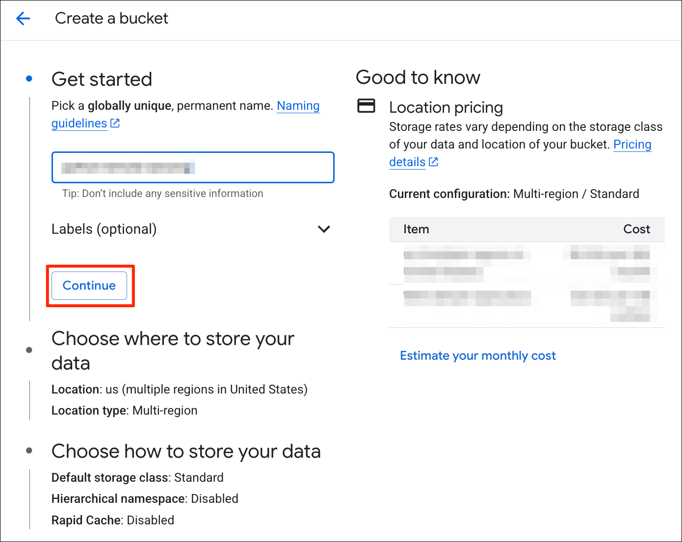
- Enter a bucket name. The bucket name has to be globally-unique as
you can refer to your bucket with just it’s name like
gs://<my-bucket-name>without referring to a project or an account name. Once you find a unique name for your bucket, click Continue.
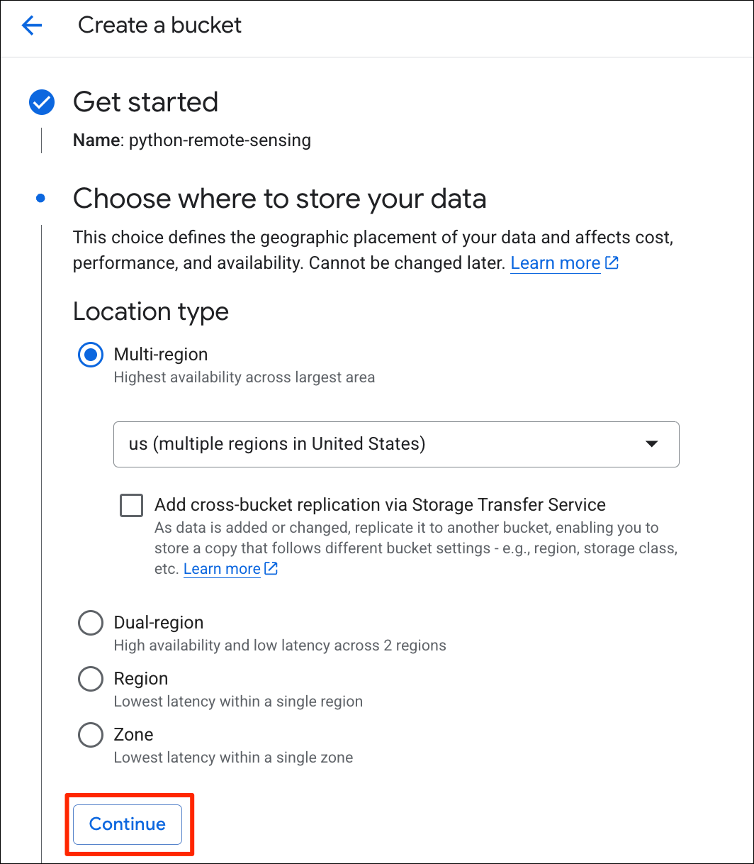
- Next, choose a region for your data. The data will be stored in a data center in the chosen region. You should choose a region closest to the users who will access the data. Click Continue.
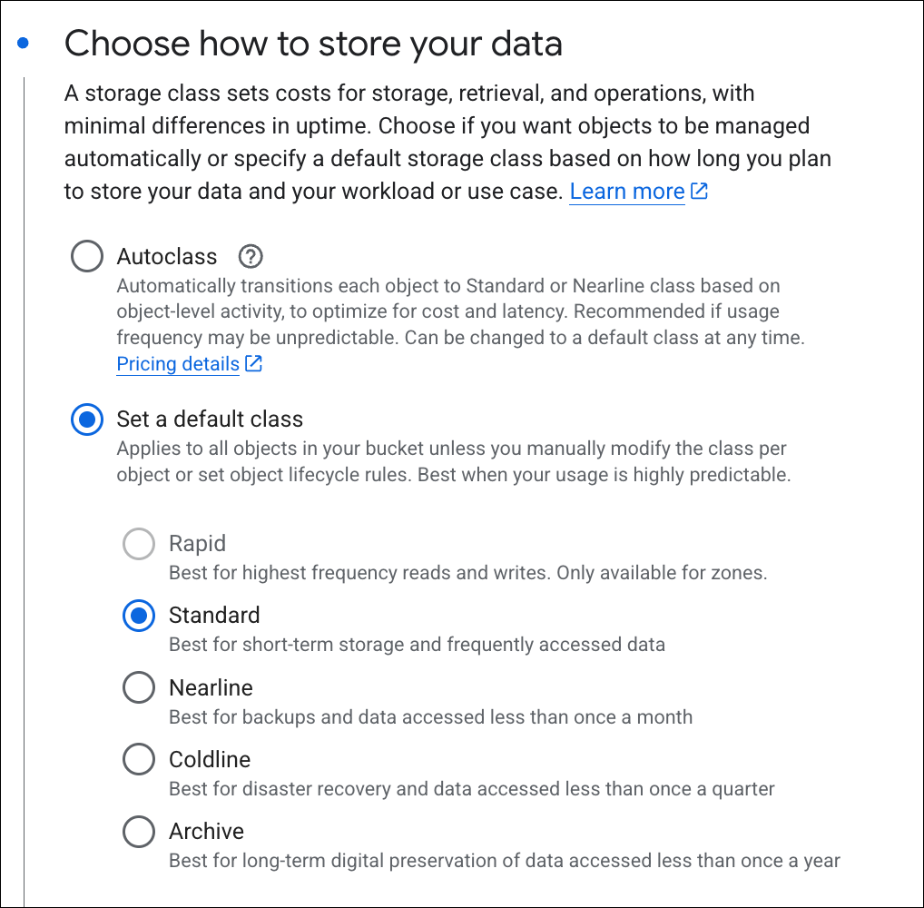
- Next, you need to decide the storage class. For data that will be accessed in your web applications and GIS viewers, the *Standard** storage class is a good choice. Click Continue.
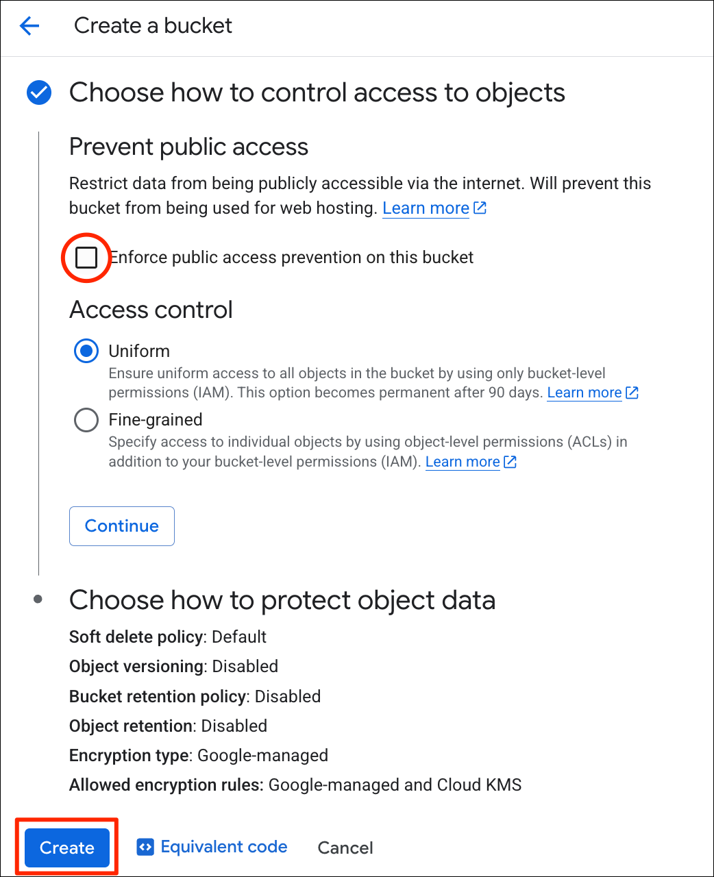
- If you are create a bucket for public access (i.e. hosting data for a website), uncheck the Enforce public access prevention on this bucket option. You can review the defaults for Choose how to protect object data and Click Create.
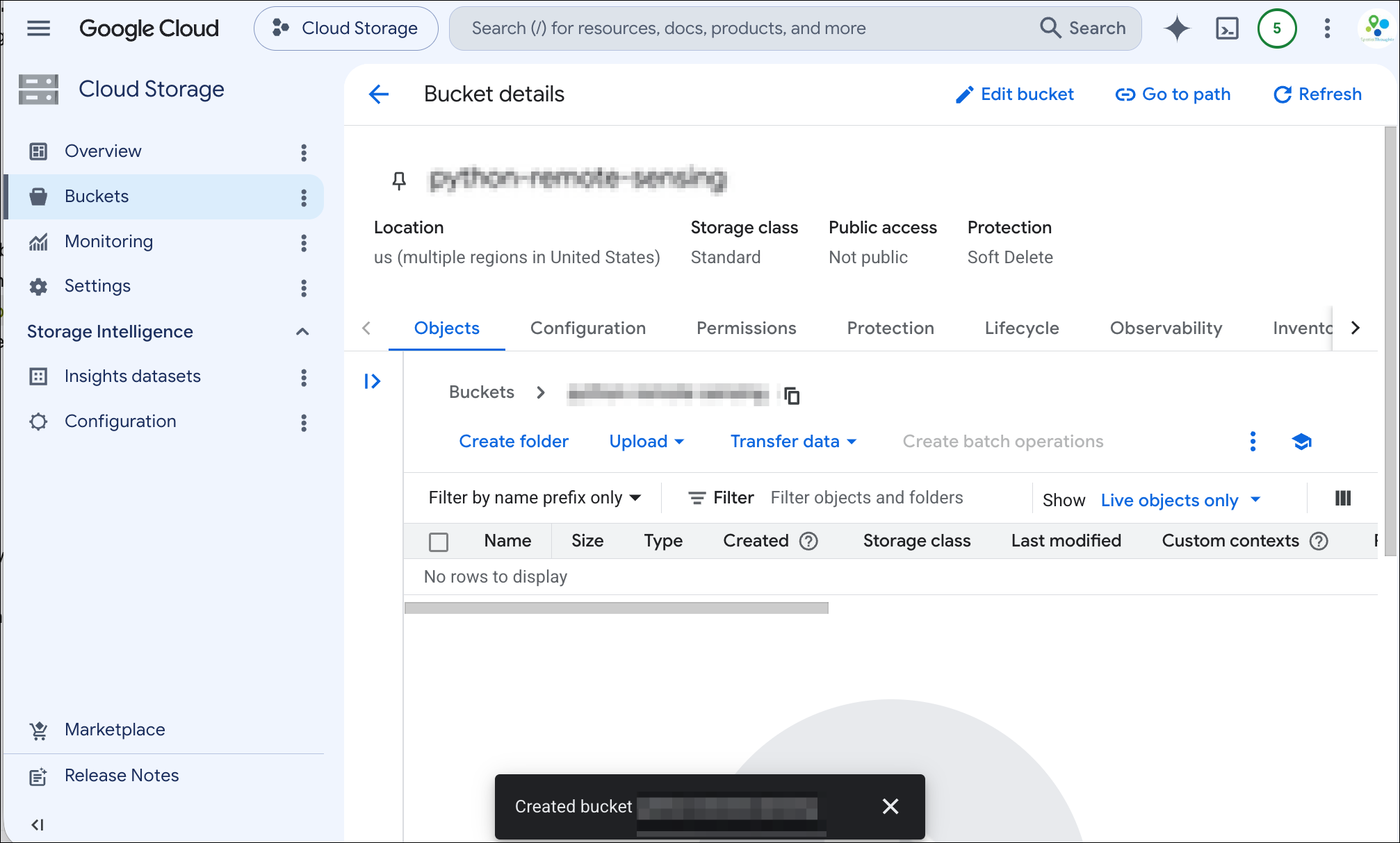
- Your bucket is now created.
Setup a CORS configuration
Cross-Origin Resource Sharing (CORS) is a browser security mechanism that allows servers to allow or block reading of data from a different domain. If you plan to access the data from your cloud storage bucket via any browser-based application (i.e. GeoLibre), you must setup a CORS configuration. Without it, browsers block cross-domain requests due to the same-origin policy.
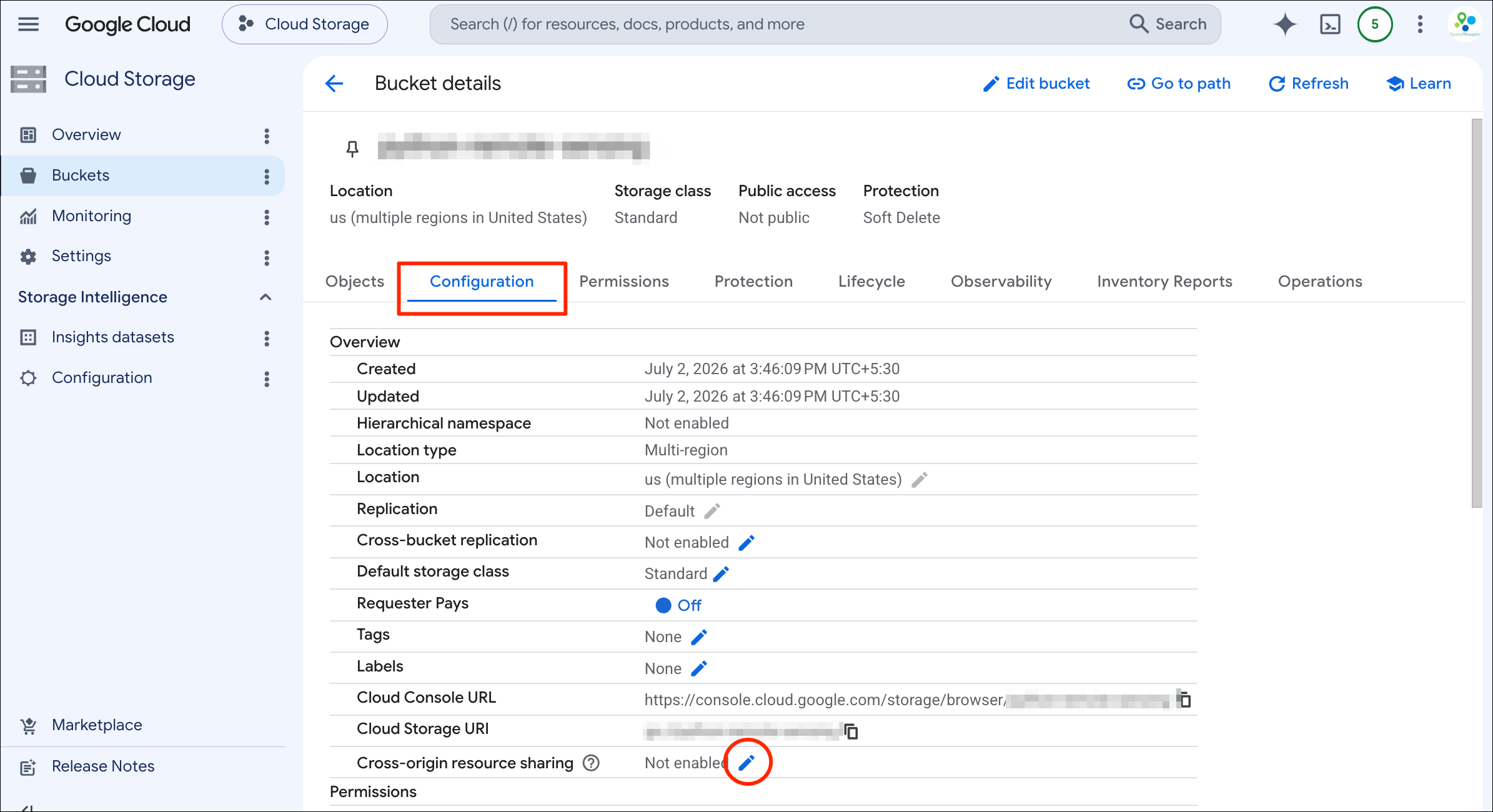
- Click your bucket name and select the Configuration tab. Locate the Cross-origin resource sharing option and click Edit.
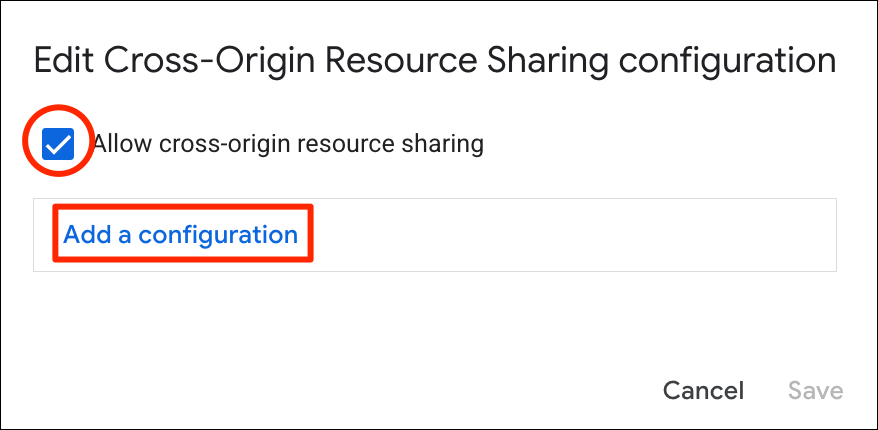
- In the Edit Cross-Origin Resource Sharing configuration dialog, check the Allow cross-origin resource sharing box and click Add a configuration.
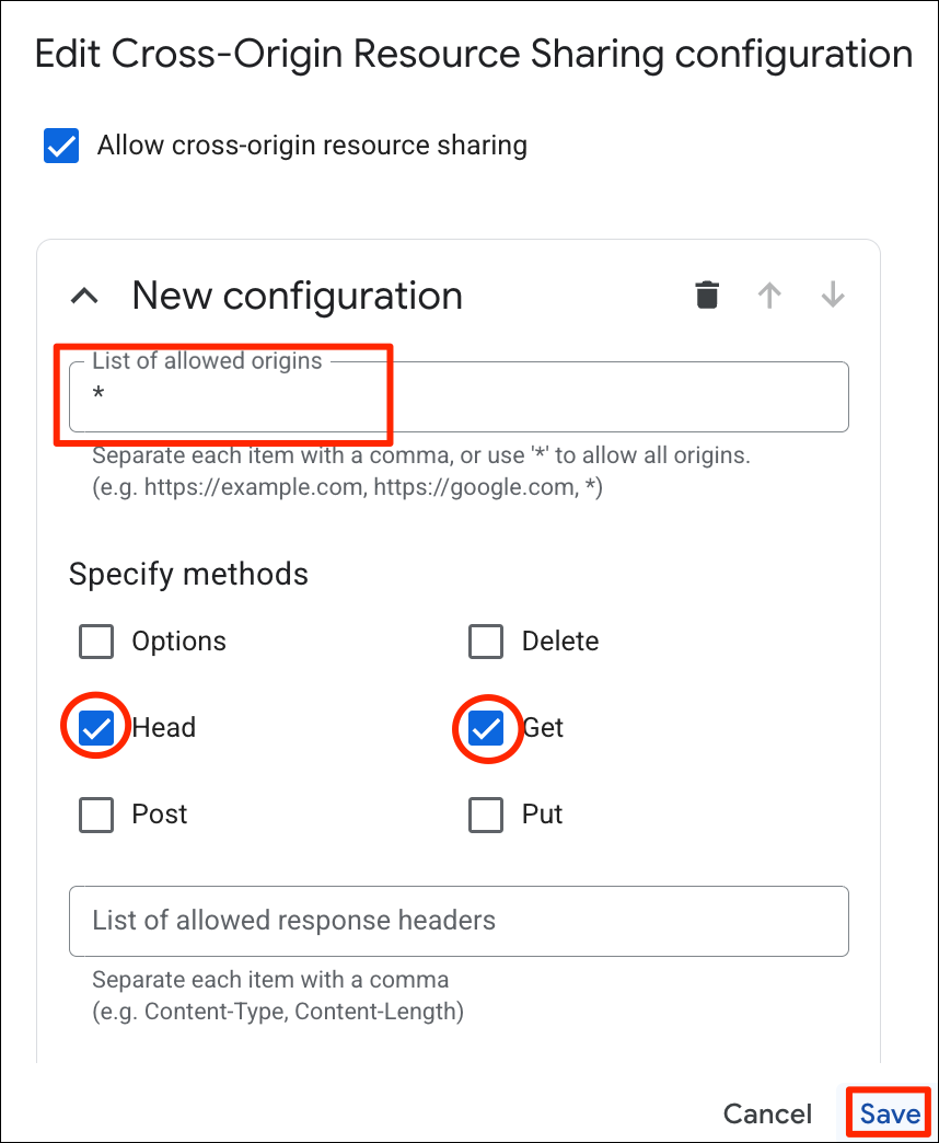
- Enter
*as the List of allowed origins and check the Head and Get methods.*indicates that any website or app can request data from this bucket. If you plan to use the data in a specific web-app, you should enter that URL instead. Head allows readers to fetch metadata (used by cloud-native files) and Get method allows fetching the data from the file. Click Save.
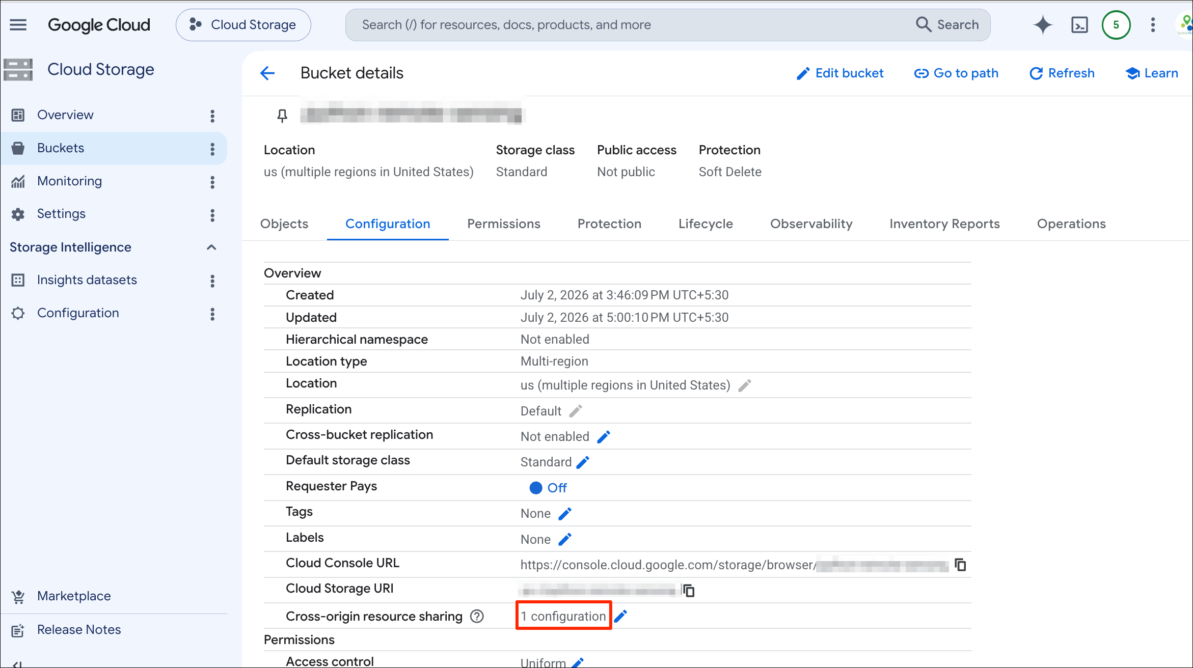
- The CORS configuration is now complete. You can now upload data to your bucket which can be read by any app or website.
If you want to report any issues with this page, please comment below.